Introduction
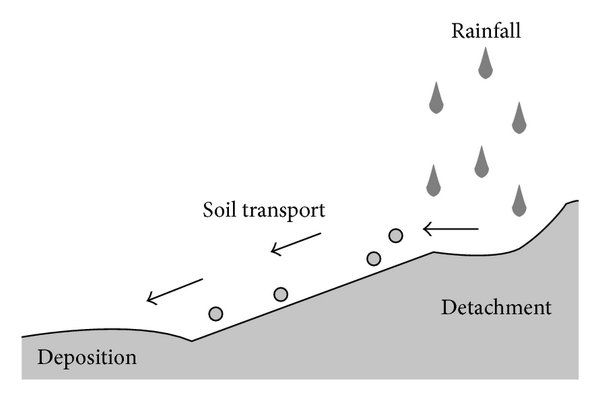
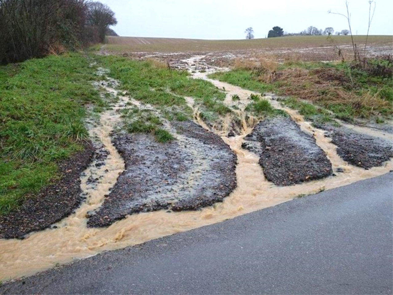
Soil erosion is a phenomenon in which water and soil are lost at the same time due to the influence of natural or man-made factors; rainwater that cannot be absorbed locally, flows downhill and washes away the soil.
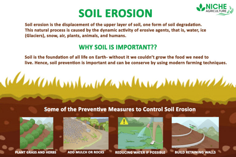
The main causes are large ground slope, inappropriate land use, destruction of ground vegetation, irrational farming techniques, loose soil, deforestation, overgrazing and so on.
The harm of soil erosion is mainly manifested in: soil tillage layer is eroded, destruction, so that the land fertility is increasingly depleted; silt rivers, channels, reservoirs, reduce the effectiveness of water conservancy projects, and even lead to drought and flooding, seriously affecting industrial and agricultural production; soil erosion of mountainous areas of agricultural production and downstream of the river to bring a serious threat.
In 2021, China added 62,000 square kilometers of new erosion control area throughout the year .
In 2022, China added 63,000 square kilometers of new soil erosion control area throughout the year.
Categories
According to produce soil erosion "power", the most widely distributed soil erosion can be divided into hydraulic erosion, gravity erosion and wind erosion three types.
1, Hydraulic erosion is the most widely distributed, in the mountains, hilly areas and all slopes of the ground, heavy rainfall will produce hydraulic erosion. It is characterized by the ground water as a driving force to wash away the soil. For example: loess plateau.
2, Gravity erosion is mainly distributed in mountainous areas, hilly areas of gullies and steep slopes, in the steep slopes and ditches on both sides of the gully wall, part of which the lower part of the water amassed, due to the soil and its into the soil matrices of their own gravity can not continue to be retained in the original position, scattered or in pieces of the collapse.
3, Wind erosion is mainly distributed in northwestern China, north China and northeastern China's deserts, sandy and hilly areas covered with sand, followed by the southeastern coastal sand, and then Henan, Anhui, Jiangsu provinces, "yellow floodplain" (historically, due to the Yellow River breaks diverted to bring out the formation of sediment). It is characterized by the wind to raise the sand particles, leaving the original position, floating with the wind to another place to land. Examples include the Hexi Corridor and the Loess Plateau.
It can also be categorized into freeze-thaw erosion, glacial erosion, mixed erosion, wind erosion, plant erosion and chemical erosion.
Solutions
Comprehensive governance
Principle: Adjust the land-use structure and combine governance with development.
1. Compressing agricultural land, focusing on the construction of Sichuan land, loess land, dam land, and gently sloping terraces, fully tapping water resources, adopting modern agricultural technology measures, improving land productivity, and gradually building basic farmland with drought and flood-proofing, and high and stable yields (basic premise).
2. Expand the area of forest and grass plantation;
3、Improve the vegetation of natural pasture, overloaded and overgrazing places should appropriately compress the number of livestock, improve the quality of livestock, and implement rotational sealing and rotational grazing;
4、Reclaiming and backfilling.
Practice: Comprehensive management of small watersheds
Focus: maintain soil and water, develop and utilize soil and water resources, and establish an organic and efficient agricultural, forestry and animal husbandry production system.
Approach: preserve loess, protect slopes and fix ditches.
Mode: engineering measures (building dams and reservoirs, leveling land, building basic farmland, pumping and diverting water for irrigation).
Biological measures
Agricultural technical measures (deep ploughing and soil reformation, scientific fertilizer application, selection and breeding of good seeds, mulching, crop rotation and replanting).